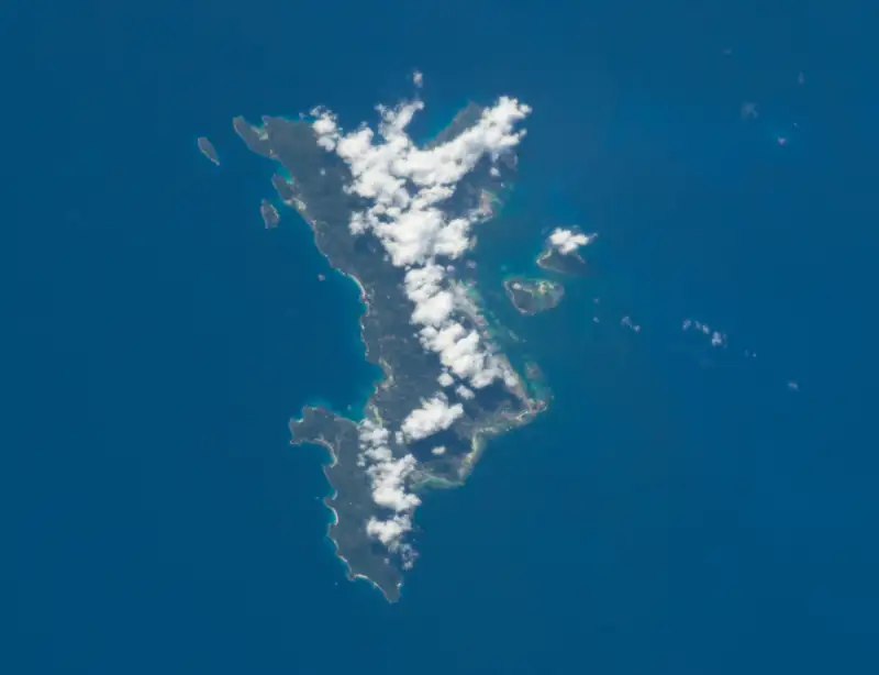
Mahé island photographed from the International Space Station, with its mountainous interior and coastline

Mahé map: Victoria, Eden Island, the marine park and Moyenne

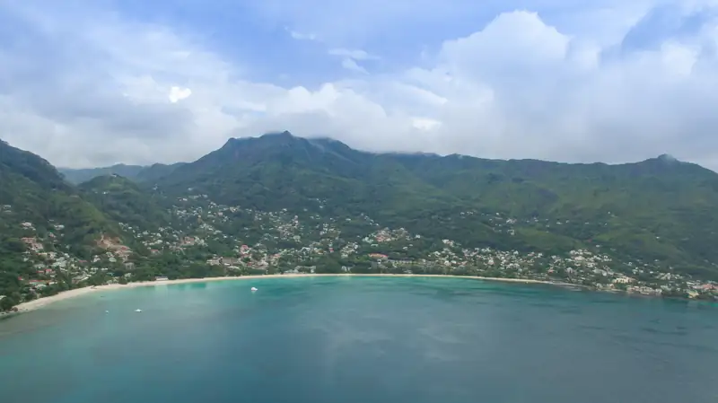
Mahé's marine park side is the north-east coast. Victoria sits there, Eden Island lies about 3 km south-east of it, and the airport is about 9.5 km south-east of Victoria. Moyenne and the other Ste Anne Marine Park islands are about 5 km offshore. Beau Vallon is over the hills on the north-west coast.

Every place on the map is also listed below.

  • Islands
  • Boat departures
  • Beaches
  • Towns
  • Sights
  • Hotels
  • Airport

Every place on the map

Islands

  • Moyenne Island (-4.6196, 55.5090)
  • Ste Anne Island (Ile Sainte-Anne) (-4.6060, 55.5042)
  • Cerf Island (Ile au Cerf) (-4.6341, 55.4984)
  • Round Island (Ile Ronde) (-4.6220, 55.5036)
  • Long Island (Ile Longue) (-4.6267, 55.5087)
  • Ile Cachee (-4.6407, 55.5052)
  • Eden Island (-4.6400, 55.4762)

Boat departures

  • Eden Island Marina (-4.6417, 55.4768)
  • Victoria Inter-Island Ferry Terminal (Inter-Island Quay, Cat Cocos) (-4.6202, 55.4587)
  • Marine Charter, Victoria (tour boat meeting point) (-4.6244, 55.4552)
  • Victoria bus station (SPTC) (-4.6195, 55.4540)

Beaches

  • Beau Vallon beach (-4.6109, 55.4302)
  • Port Launay (beach, marine park) (-4.6536, 55.3999)
  • Anse Major (-4.6264, 55.3855)

Towns

  • Victoria (-4.6232, 55.4524)
  • Roche Caiman (-4.6376, 55.4677)
  • Mont Fleuri (-4.6337, 55.4562)
  • Anse aux Pins (-4.6895, 55.5161)
  • Cascade (-4.6691, 55.4973)
  • Bel Ombre (-4.6194, 55.4113)

Sights

  • Victoria Clock Tower (-4.6232, 55.4523)
  • National Botanical Garden, Mont Fleuri (-4.6303, 55.4530)
  • National Museum of History, Victoria (-4.6234, 55.4526)
  • Sir Selwyn Selwyn-Clarke Market (old site, under renovation) (-4.6213, 55.4514)
  • Eden Plaza (shops and restaurants, Eden Island) (-4.6407, 55.4759)
  • Copolia (summit) (-4.6492, 55.4583)
  • Mission Lodge, Sans Souci (-4.6558, 55.4453)
  • Takamaka Rum distillery, La Plaine St Andre (-4.7195, 55.5233)

Hotels

  • Eden Bleu Hotel (-4.6405, 55.4768)
  • L'Escale Resort Marina & Spa (-4.6462, 55.4762)
  • Hotel Bel Air (-4.6254, 55.4488)
  • Le Chateau Bleu (-4.6899, 55.5271)
  • Berjaya Beau Vallon Bay Resort & Casino (-4.6153, 55.4271)
  • Coral Strand Smart Choice Hotel (-4.6131, 55.4290)
  • Savoy Seychelles Resort & Spa (-4.6124, 55.4310)
  • STORY Seychelles (formerly The H Resort) (-4.6161, 55.4250)
  • Club Med Seychelles (Ste Anne Island) (-4.6107, 55.4989)
  • Cerf Island Resort (-4.6309, 55.4924)
  • L'Habitation Cerf Island (-4.6343, 55.4930)
  • Enchanted Island Resort (Round Island; island centre, resort not mapped separately) (-4.6220, 55.5036)

Airport

  • Seychelles International Airport (SEZ) (-4.6743, 55.5212)

Mahé is about 26 km long and 17 km wide, with mountains in the middle rising to 905 m at Morne Seychellois. Everything to do with Moyenne happens on the north-east side: Victoria, Eden Island, the airport road and, 4 to 6 km offshore, the six islands of the Ste Anne Marine National Park. The beach resorts of Beau Vallon are on the other side of the hills, on the north-west coast.

The map above plots every place on this page from OpenStreetMap coordinates. Below, we explain how the pieces fit together.

Where Moyenne Island is

Moyenne sits in the middle of the marine park cluster, east of Victoria and north-east of Eden Island. Wikipedia gives its position as 4°37′10″S 55°30′31″E, which matches OpenStreetMap.

Straight-line distances from Moyenne, measured between OpenStreetMap coordinates (centre to centre, not a boat route):

From Moyenne to Distance
Round Island 0.6 km
Long Island 0.8 km
Ste Anne Island 1.6 km
Cerf Island 2.0 km
Ile Cachée 2.4 km
Eden Island Marina 4.3 km
Victoria Inter-Island Quay 5.6 km
Seychelles International Airport 6.2 km
Beau Vallon beach 8.8 km

By boat, SPGA calls the park a 10-minute ride from Victoria. Allow 10 to 15 minutes to Moyenne itself.

Ste Anne Marine Park map

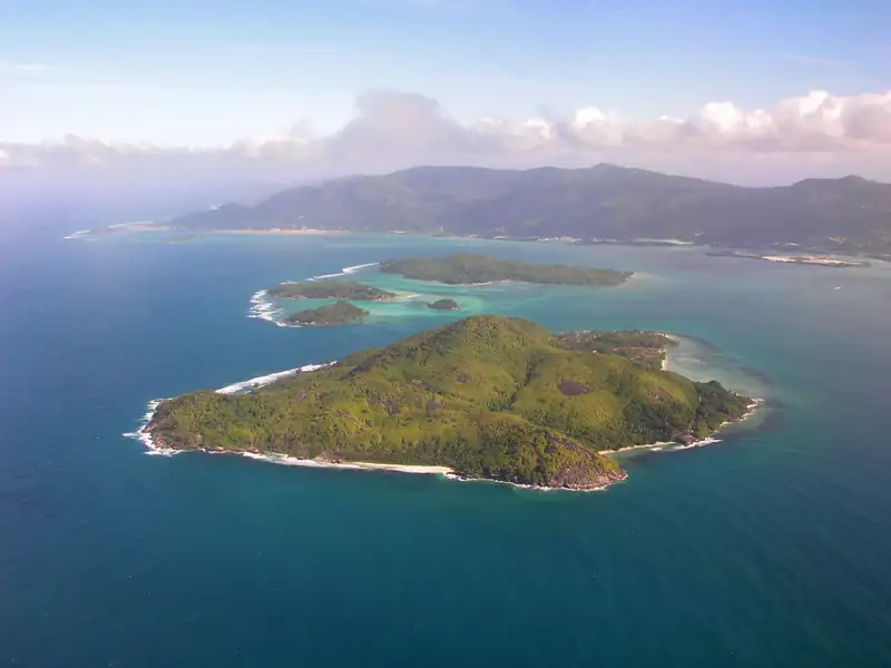
The park covers 14.53 km² (SPGA) and has six islands. Seen from Moyenne:

  • Ste Anne is to the north, the largest island in the park. Club Med occupies it and day visits are restricted.
  • Round Island is just west, under 1 km away, with the Enchanted Island Resort. Also closed to day visitors.
  • Long Island is just south. A new resort is planned there; we don’t know of one open.
  • Cerf is to the south-west, the second largest and the closest to Eden Island, about 2.5 km from the marina. Many day trips stop here for a barbecue lunch.
  • Ile Cachée is to the south, a small nature reserve with seabird colonies.

Moyenne itself is about 400 m by 300 m. Our marine park guide covers each island.

Boat departure points

There is no public ferry to Moyenne. Tours and charters leave from two places on Mahé:

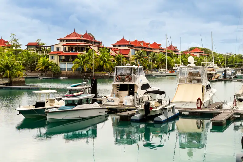
  1. Eden Island Marina, beside Eden Plaza on Eden Island. Semi-submarine, clear-boat and many glass-bottom trips start here, plus private charters and the hotel boats to Cerf. See the Eden Island guide.
  2. Victoria, at the Inter-Island Quay and the Marine Charter area off Telemaque Road, about 0.6 km apart. Creole Travel Services’ catamaran and several glass-bottom boats use these, and the Cat Cocos ferries to Praslin and La Digue leave from the Inter-Island Quay.

The two are about 3.1 km apart in a straight line and about 7 minutes apart by road without traffic. No Moyenne boats leave from Beau Vallon. Hotels there rely on pickups.

Victoria map

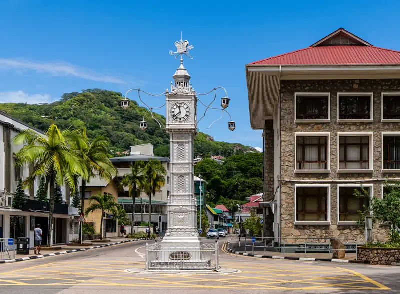
Victoria is small enough to walk. Straight-line distances from the Clock Tower in the centre:

Place Distance from the Clock Tower
National Museum of History next door
Old market site (under renovation) 0.2 km
Marine Charter boat area 0.3 km
SPTC bus station 0.4 km
Hotel Bel Air 0.5 km
Inter-Island Quay 0.8 km
National Botanical Garden, Mont Fleuri 0.8 km south

The Seychelles Nation puts the botanical garden about 20 minutes’ walk from the centre. The market has traded from a temporary building since its renovation began in 2025. For what to see, read our Victoria guide.

Hotel areas on the map

Area Where it is To Eden Island Marina by road To Victoria quay by road
Eden Island Off Roche Caiman, east coast 0.4 km, walk about 7 minutes without traffic
Roche Caiman Mainland shore beside Eden Island about 4 minutes without traffic about 7 minutes without traffic
Victoria and Bel Air North-east coast, the capital about 7 minutes without traffic about 4 minutes without traffic
Anse aux Pins East coast, south of the airport about 11 minutes without traffic about 14 minutes without traffic
Beau Vallon North-west coast, over the hills about 14 minutes without traffic about 11 minutes without traffic

Drive times come from the OSRM route planner on OpenStreetMap data and assume empty roads, so treat them as a minimum. Our where to stay in Mahé guide names the hotels in each area.

The airport and main road distances

Seychelles International Airport is on the east coast, south-east of Victoria. Road distances (OSRM, without traffic):

Route Distance Time
Airport to Eden Island Marina 7.5 km about 9 minutes
Airport to Victoria Clock Tower 10.4 km about 10 minutes
Airport to Victoria Inter-Island Quay 10.8 km about 12 minutes
Airport to Beau Vallon beach 14.3 km about 19 minutes
Victoria quay to Eden Island Marina 4.4 km about 7 minutes
Beau Vallon to Victoria quay 5.3 km about 11 minutes

Other places worth finding

  • Copolia trail: trailhead on the Sans Souci road at Val Riche, about 6 km from Victoria. The summit looks over the airport, Victoria’s harbour and the marine park islands.
  • Mission Lodge: at Sans Souci, 450 m up and about 6 km from Victoria.
  • Port Launay marine park: on the west coast, about 30 minutes’ drive from Victoria via La Misère.
  • Anse Major: a beach on the north-west coast, reached by a trail from Danzilles at Bel Ombre, past Beau Vallon.
  • Takamaka rum distillery: at La Plaine St André, 7 km south of the airport on the east coast road.

Mahé on the Seychelles map

Mahé is the largest of the Seychelles islands. Praslin, the second largest, is about 45 km north-east, 1 hour 15 minutes by Cat Cocos ferry, with La Digue just east of it. Aldabra, home of the wild giant tortoises, is over 1,000 km south-west. For choosing between the islands, see where to stay in Seychelles.
Tours that land on Moyenne

Lands on Moyenne

Mahé: Saint-Anne Marine Park and Moyenne Island Cruise

4.7 (580 reviews)7 hours

A catamaran day in the marine park with snorkel stops, a Creole lunch and a guided walk among the tortoises on Moyenne, with the island landing fee already paid.

Lands on Moyenne

Mahe: St.Anne Marine National Park Reef Safari with Lunch

4.6 (323 reviews)7 hours

Reef viewing from a semi-submersible, a snorkel, a buffet lunch with live music, then time ashore on Moyenne to find the tortoises and the old graves.

Lands on Moyenne

St. Anne Marine Park, Moyenne & Cerf Island Tour with Lunch

4.2 (1,185 reviews)6-6.5 hours

The cheapest and most-booked marine park day: glass-bottom boat from Eden Island, snorkelling, the Round and Long Island sandbank, a stop at Moyenne and a beach barbecue on Cerf.

Prices and ratings were taken from GetYourGuide and can change. Booking through these links supports this site at no extra cost to you.

See all Moyenne and Seychelles tours

Questions people ask

Where is Moyenne Island on the map?

Moyenne is off the north-east coast of Mahé, inside the Ste Anne Marine National Park, at about 4°37′S 55°30′E. In a straight line it is about 5.6 km east of Victoria's Inter-Island Quay and about 4.3 km north-east of Eden Island Marina. Round Island and Long Island are its nearest neighbours, both under 1 km away.

How big is Mahé?

About 157 km², roughly 26 km long and 17 km wide, which makes it the largest island in Seychelles. Its highest point is Morne Seychellois at 905 m, inside the national park that covers more than a fifth of the island. Most of the population lives on Mahé, and it has the international airport and the capital, Victoria.

Which islands are in the Ste Anne Marine Park?

SPGA lists six: Ste Anne, Moyenne, Round Island (Ile Ronde), Long Island (Ile Longue), Ile Cachée and Cerf (Ile au Cerf). Ste Anne is the largest and lies north of Moyenne. Cerf is to the south-west, closest to Eden Island. The park covers 14.53 km² and lies about 5 km off Mahé.

How far is Victoria from the airport?

About 10.4 km by road to the Clock Tower, roughly 10 minutes without traffic according to the OSRM route planner. The airport is on the east coast, south-east of Victoria, with Eden Island in between. In traffic it takes longer: GOV.UK calls Mahé's roads narrow and winding, and the government launched a park-and-ride trial in December 2025 to ease traffic in Victoria.

Is Beau Vallon close to Victoria?

In a straight line, yes: about 2.8 km. But the hills of the north of Mahé sit between them, so the road route is about 5.3 km and roughly 11 minutes without traffic. Beau Vallon faces north-west, away from the marine park, so boat trips to Moyenne from there start with a drive or a hotel pickup.